
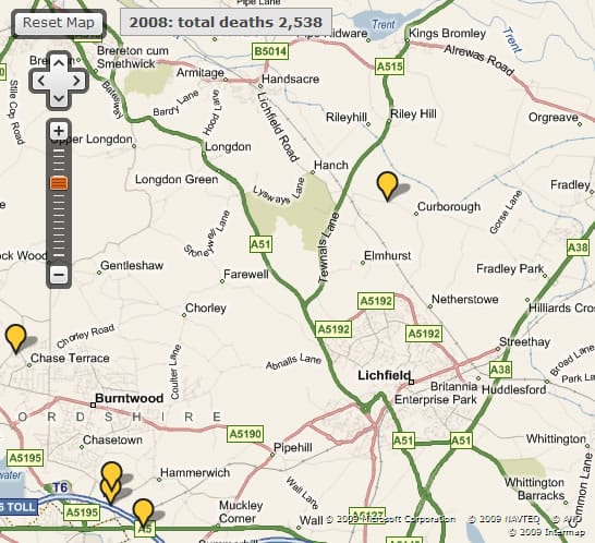
A new map showing the locations of road deaths during 2008 has revealed that there were a total of five fatalities on Lichfield’s roads.
Among these were a 69-year old man on Wood End Lane near Curborough and an 11-year old boy in Chasetown.
There were a total of 48 deaths recorded throughout the whole of Staffordshire and figures are available for 1999 to 2008. The map was created using data released by the Department of Transport.


